Driving Directions
Your smartphone or GPS or a number of Internet websites can provide turn-by-turn directions to assist you in getting to the Yuma Hamfest. The address of the Yuma County Fairgrounds is 2520 E. 32nd Street in Yuma, AZ. If you're driving from out of state, you may want to check the latest Arizona road conditions.
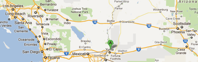
Yuma is located midway between San Diego and Phoenix on Interstate 8. To our high tech friends, we're located at GPS coordinates N32° 40.403' W114° 35.644'. Even though you may know how to get to Yuma, you may still need a map to get to the Yuma County Fairgrounds where the Hamfest is located. Four maps are included here to assist.
The big picture, showing where Yuma is, roughly halfway between San Diego and Phoenix:
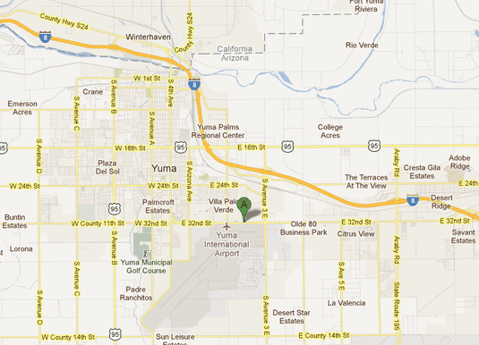
A map of the city of Yuma. The Fairgrounds is highlighted with the "A". As you can see, the Fairgrounds is across the street from the Yuma International Airport, which should help you find us:
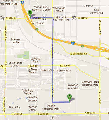
If you are camping, tailgating or are a vendor:
If you are a camper, tailgater or vendor (or required disabled parking), take Exit 2 (16th Street exit). Go east 0.6 mile on 16th to Pacific Ave and turn right. After turning on Pacific Avenue, go south about 1.8 miles to the Fairgrounds entrance on your left. Watch for the feather flags and the 'Yuma Hamfest' banner at the entrance just south of the Big O store.
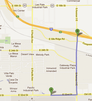
If you are just attending the hamfest:
If just attending the hamfest, take Exit 3 (Avenue 3E) off of Interstate 8 and go south 1.4 miles to 32nd Street. At 32nd Street, turn right and go about 0.5 mile and turn into the fairgrounds parking lot by the large marquee sign.